Accuracy
Quality-controlled acquisition and processing.
Geophysical & Environmental Consultancy
High-accuracy, standards-based geophysical surveys for groundwater, engineering, environment, mining, archaeology and infrastructure projects.
Who we are
MaxRes Geophysics is a professional geophysical and environmental consultancy serving governmental and private sectors. We provide practical, innovative and high-accuracy solutions for surface and subsurface investigations.
Quality-controlled acquisition and processing.
Cost-effective survey planning for each objective.
Actionable interpretation and clear reporting.
Our services
Define objectives, select methods and build an efficient field strategy.
High-quality field measurements with rigorous quality control.
Advanced workflows for robust 1D, 2D and 3D subsurface models.
Integrated technical interpretation presented in decision-ready reports.
Geophysical methods
Click any method to see how it works and where we use it.
Applications
Delineating aquifers, estimating depth to water-bearing units, and mapping freshwater–saline water interfaces.
Imaging weak zones, bedrock geometry, cavities and subsurface conditions that influence design and construction.
Characterizing landfills, conductive leachate zones and potential subsurface pathways for contaminant migration.
Mapping geological structures, alteration zones and physical-property contrasts associated with mineralized targets.
Regional mapping of basement architecture, faults, basin geometry and structural trends using potential-field methods.
Non-invasive detection and mapping of buried walls, foundations, tombs, cavities and other archaeological features.
Locating buried utilities, voids and shallow infrastructure to support safer excavation and urban planning.
Investigating seepage, fractures, weathered zones, foundation conditions and other geotechnical anomalies.
Detecting and prioritizing metallic targets and buried objects using high-resolution magnetic and electromagnetic surveys.
Selected experience
Examples drawn from peer-reviewed field investigations carried out by members of our technical team.
 ERT · TEM · MAG
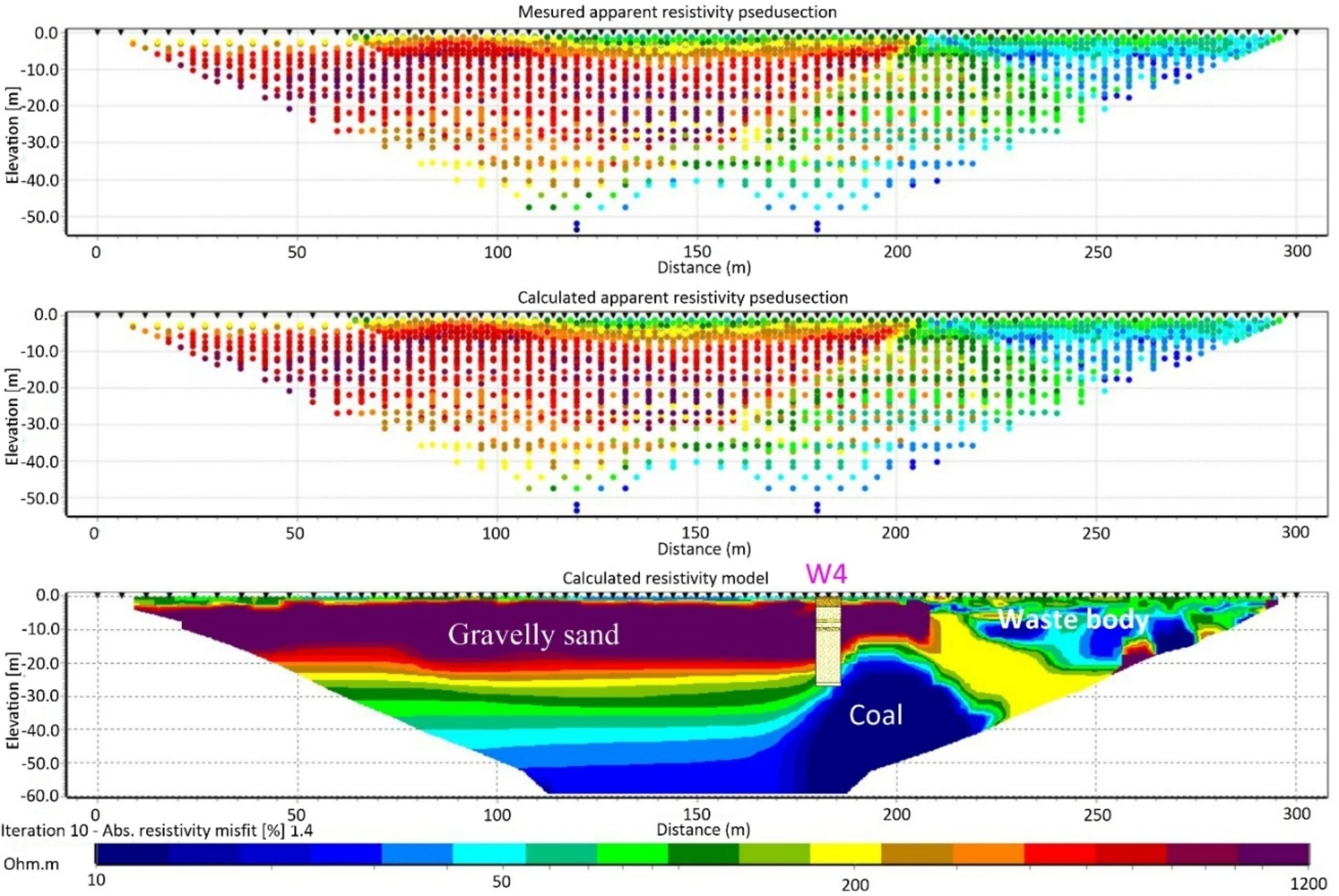
Integrated magnetic, ERT and TEM imaging to delineate waste geometry and investigate conductive zones associated with possible contaminant migration.
Project image: 3D ERT fence diagram, Scientific Reports (2024), CC BY 4.0.
View scientific study ↗ TEM · 1D INVERSION
Regional and local TEM surveys used to image resistivity variations, freshwater–saline water distribution and potential intrusion pathways in a coastal aquifer.
Project image: stitched 1D TEM resistivity section, Water (2025), CC BY 4.0.
View scientific study ↗ HIGH-RES MAGNETICS · IAS
High-resolution magnetic processing and phase-based filtering for precise detection and enhancement of anomalies generated by buried unexploded ordnance.
Project image: real UXO test-site magnetic maps, Remote Sensing (2021), CC BY 4.0.
View scientific study ↗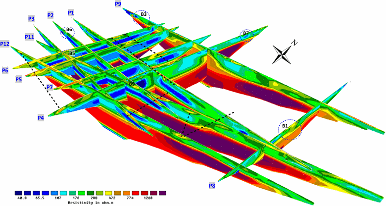 ERT · MAGNETIC GRADIOMETRY
Magnetic gradiometry and targeted ERT were integrated to investigate shallow anomalies interpreted as possible remains of an ancient church and associated structures.
Project image: 3D ERT resistivity fence diagram from Fig. 13 of the published Neuss-Norf archaeogeophysical study.
View scientific study ↗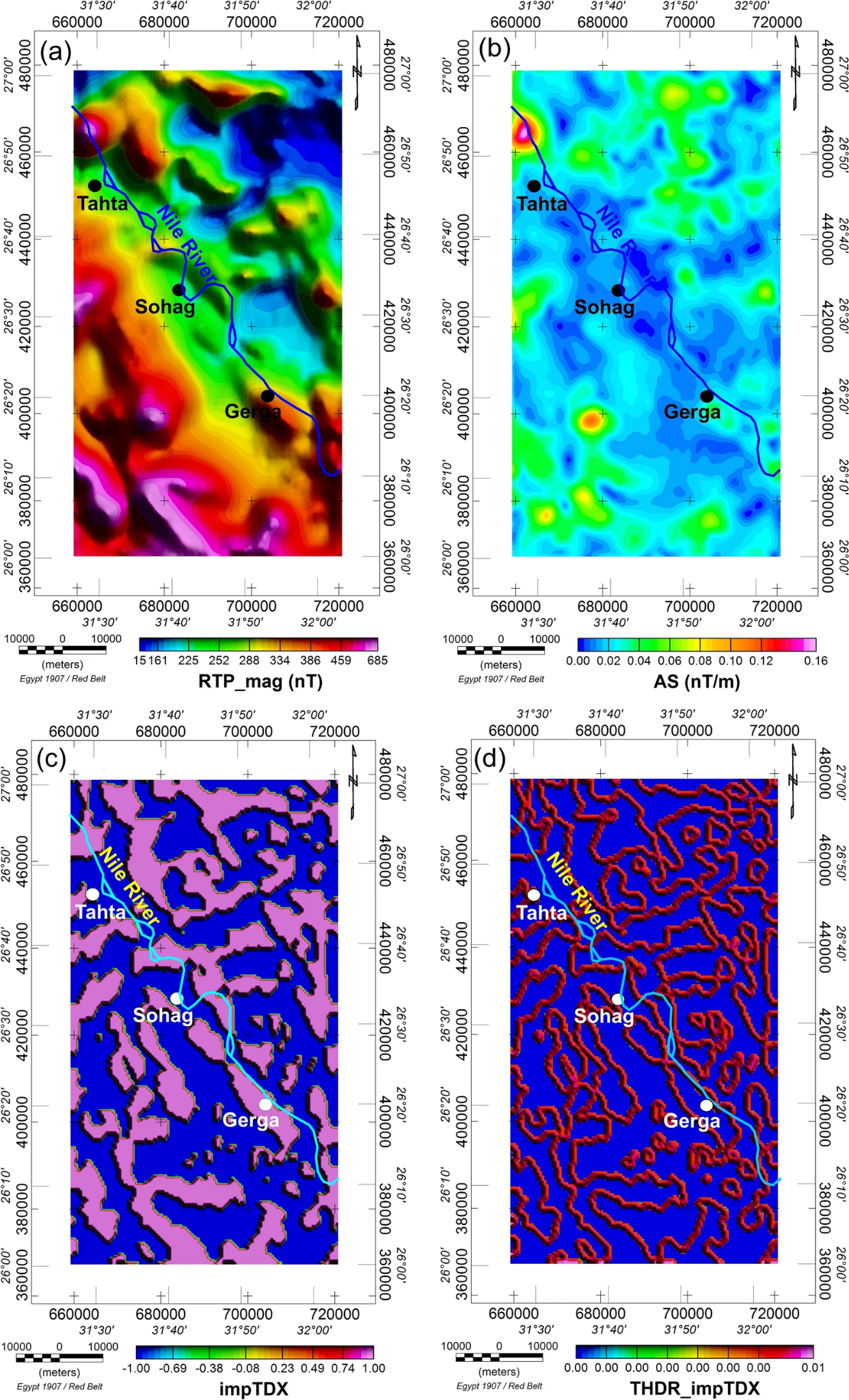 AEROMAGNETICS · EDGE DETECTION
Advanced magnetic edge-enhancement and interpretation used to sharpen source boundaries and map faults, horsts and grabens controlling the regional structural framework.
Project image: interpreted structural map derived from impTDX/THDR_impTDX magnetic processing, Pure and Applied Geophysics (2023), CC BY 4.0.
View scientific study ↗Start a project
Contact MaxRes Geophysics to discuss your site, objectives and the most effective survey approach.
Project enquiry
Tell us briefly about your site and objectives. You can also attach a map, photograph, report or other supporting file.